Mapping the Punjab
This section highlights a series of maps of India and the Punjab from the University’s Special Collections. These maps capture the changing landscape of empire over the course of a century, from 1846 to 1969, and expose legacies of conflict, colonialism and partition.
It is important to remember that maps are subjective projections which reflect the views of their creators, and the majority of the maps in this section were produced by the British. We encourage you to consider who these maps were made for, why they were created, and what interests they serve. For further information on colonial mapping, the Library’s Map Curator, Donna Sherman, has written a blog post on the subject.
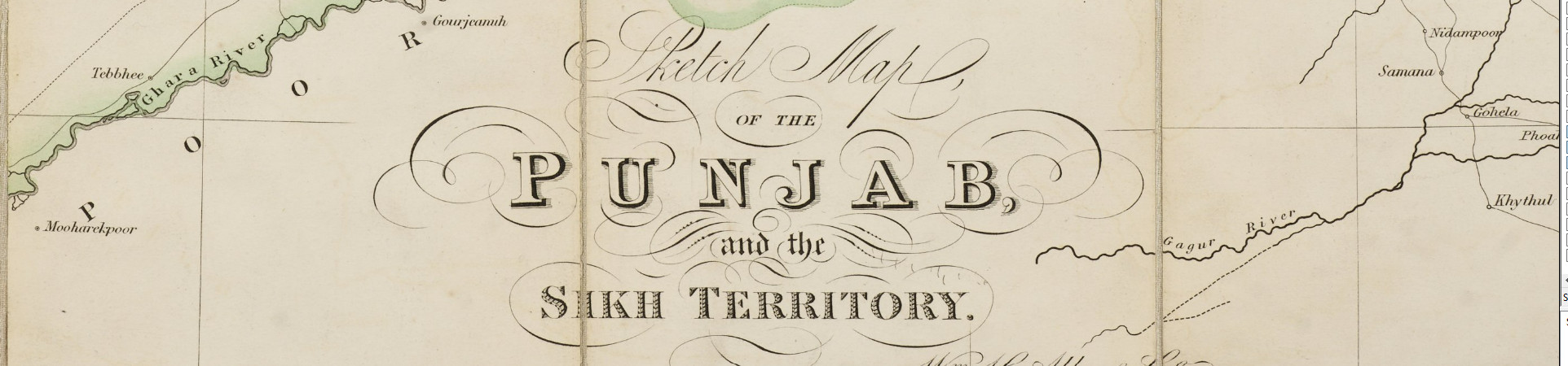
Created at the end of the First Anglo Sikh War, this map shows the territories controlled by the Sikh Empire, outlined in faint green. It was produced for the East India Company, who had ambitions to annex Sikh lands, an aim achieved at the end of the Second Anglo-Sikh war in 1849.
MMGS: D (296)
The Indian Mutiny of 1857, or First War of Independence, witnessed widespread resistance to the rule of the East India Company, which resulted in the British government taking control of India.
MMGS: D (294)
From 1857 onwards, the British invested significantly in transportation.
Railways offered many economic benefits to the colonial state, easing the import and sale of British goods, and the export of raw materials such as cotton. They benefitted Indians too, enabling social mobility and transformation by making large swathes of the country accessible for travel.
D1:7 (15)
The Punjab had some of the densest rail networks in the nation in 1944, and we can see how interconnected the area was before partition three years later.
Partition
The end of British colonialism in India in 1947 resulted in the creation of the new country of Pakistan, carved out from existing Indian territories. The Punjab and Bengal were arbitrarily partitioned by British administrators.
Across the Punjab, Sikhs, Hindus and Muslims were instructed to uproot their lives. In the largest forced migration of people in history, close to 15 million people travelled across borders for miles in search of new homes. It is estimated that between 1 and 2 million people died. Partition remains a traumatic event that looms large in the collective memory of these communities.
This British atlas from 1948 shows the new boundaries of India and Pakistan, with Pakistan split into two areas to the west and east. The new border between India and Pakistan in the west is clearly visible, cutting through the Punjab and splitting formerly Sikh majority areas.
This map was created by the Indian government in 1969, showing part of the Punjab including Amritsar and Lahore, now split between India and Pakistan. The stark division between the two countries is illustrated in the use of colour and level of detail provided.